Steall Falls and Nevis Gorge
Parking for these walks is normally the Nevis Gorge car park. Drive past the visitor centre for approx. 5.5km where the road crosses the Lower Falls. Continue on the single track road to the end where there is a small parking area for approx. 30 - 40 cars.
This walk is approx. 4.5 km (2.75 miles) so allow 1.5 hours.
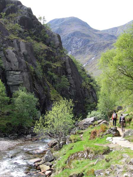
At the far end of the car park you will find the start of the Gorge path. The track guides you through a natural wood of birch, hazel, oak, willow, and Scot's pine.
The path is narrow and steep-sided in places and over-hung by cliffs. It then opens out into the meadow and you are greeted by wonderful views of the waterfall An Steall (the spout), the third highest falls in Scotland at 105 metres.

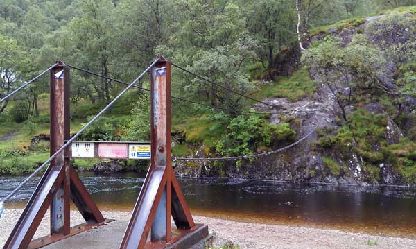
A wire bridge allows you to cross the river if you are brave enough to use the single foot wire and wire handrails while suspended above a river. For the less inclined it is possible to pick a spot to gingerly cross the river as long as it is not too high. As always, care and good judgement are the order of the day.
This path continues all the way through to Corrour Station although this is a seldom used route, but for those who aren't planning this long trek, a walk to the ruins is worthwhile.
Return to the car park by the same route.